Geomatics Engineering
Geomatics Engineering
Geomatics engineers manage global geospatial resources and infrastructure. They design, develop, and operate systems for collecting, analyzing, and
utilizing geospatial information about the land, infrastructure, the oceans, natural resources, and the environment.
In Civil Engineering's Geomatics Engineering emphasis area, you will have the opportunity to study property boundary determination, digital
mapping, geodesy, geographic information systems (GIS), global positioning systems (GPS), land information management, photogrammetry, and
remote sensing. The Geomatics faculty are dedicated to effective teaching and cutting-edge research.
There are two ways to pursue a master level graduate study in Geomatics Engineering. For those interested in a specialized, focused curriculum of Geomatics Engineering, application can be made through the School of Civil
Engineering at http://eng.purdue.edu/CE/Academics/Graduate. For those with an interdisciplinary
background, the application can be made through the Purdue Engineering Professional Education program at
http://eng.purdue.edu/ProEd.
Spotlights
April 8, 2009
Nathan Ovans recently received the Francis H. Moffitt Memorial Scholarship from the American Society for Photogrammetry and Remote Sensing.
February 23, 2009
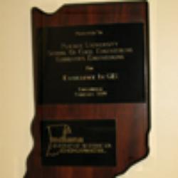
Issued by the Indiana Geographic Information Council, the award was presented at the 2009 Indiana GIS Conference.
January 7, 2009
This volume provides the first systematic, in-depth introduction to the basic theories & principles of LiDAR (Light Detection and Ranging) technology and data processing.
October 27, 2008
Prof. Jie Shan has recently been selected as an Associate Editor for IEEE Transactions on Geoscience & Remote Sensing, and the Assistant Editor for Photogrammetric Engineering & Remote Sensing.
October 9, 2008
Detailed maps depicting the severity of the floods that impacted southern Indiana in June 2008
May 23, 2008
Prof. Jie Shan received a grant from the NOAA Indiana/Illinois Sea Grant Program.
November 14, 2007
3-D modeling of Purdue's Engineering Island area presented in Google Earth
November 2, 2007
His team will be working on Mars topographic mapping using orbital imagery and laser ranging, and the calibration of the instruments aboard.
April 4, 2007
Associate Professor Jie Shan, Associate Professor James S. Bethel, Professor Edward M. Mikhail, Chiumng-Shiuan Fu, Bin Li, and Jeffrey Kretsch received Talbert Abrams Grand Award for their journal paper, entitled "Principles and Evaluation of Autostereoscopic Photogrammetric
Measurement."
March 8, 2007
Research has revealed that approximately 511.3 km2 of the earth's surface was submerged.
January 22, 2007
Jen-Yu Han, Geomatics Engineering Ph.D. student, has received the 2006/2007 Stevan J. Kristof Outstanding Graduate Student in Remote Sensing Award.
August 3, 2006
At the Civil Engineering Scholarship and Awards program held April 27, 2006, Clint Roos received the John G. McEntyre Endowment Scholarship.


